 Mixing
Mansehra
Mansehra مانسہرہ | |
|---|---|
District Headquarter / City | |
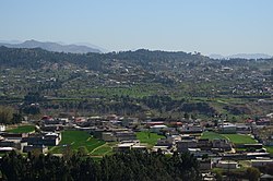 Mansehra is surrounded by verdant mountains | |
 Mansehra Show map of Pakistan 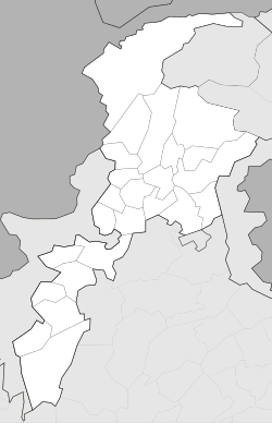 Mansehra Show map of Khyber Pakhtunkhwa | |
| Coordinates: 34°20′2″N 73°12′5″E / 34.33389°N 73.20139°E / 34.33389; 73.20139Coordinates: 34°20′2″N 73°12′5″E / 34.33389°N 73.20139°E / 34.33389; 73.20139 | |
| Country | |
| Province | |
| District | Mansehra |
| Tehsil | Mansehra |
| Area [1] | |
| • Total | 1,340 km2 (520 sq mi) |
| Elevation | 1,088 m (3,570 ft) |
| Population (2017)[2] | |
| • Total | 144,855 |
| Time zone | UTC+5 (PST) |

Ashokan inscriptions: Major Rock Edicts 1 to 14.

The giant rock of Ashoka.
Mansehra (Gojri/Hindko/Urdu/Pashto: مانسہرہ) (elevation 1,088 m (3,570 ft)) is capital city of Mansehra District in the eastern part of Khyber Pakhtunkhwa province in Pakistan.[3] Mansehra is one of the largest cities of Khyber Pakhtunkhwa. Kashmir lies to the east.
The name of the city is derived from that of its founder, Sardar Maha Singh Mirpuri, who was a Sikh administrator and general in the Sikh Khalsa Army during the rule of the Khalsa Empire of Maharaja Ranjit Singh.[4][5][6]
Contents
1 History
1.1 Maurya Dynasty
1.2 Sikh rule
1.3 British period
2 Organisation
3 Cultural festival
4 References
5 External links
History
Maurya Dynasty
Ashoka governed this area as a prince, imperial throne c. 272 B.C. he made it one of the major seats of his government. The Edicts of Ashoka inscribed on three large boulders near Mansehra record fourteen of Ashoka's edicts, presenting aspects of the emperor's dharma or righteous law. These represent some of the earliest evidence of deciphered writing in South Asia, dating to middle of the third century BC, and are written from right to left in the Kharosthi script.[7]
Sikh rule
The fall of the Afghan Durrani Empire made way for the Sikhs to rise to power under Ranjit Singh. The Sikhs gained control of the area in 1818. The town of Mansehra was founded by Mahan Singh Mirpuri, a Sikh governor.[8] There were popular uprisings against Sikh rule, but these uprisings failed and the Sikhs remained in power until 1849 when the area came under British rule.[5][self-published source][6][9][10] The town is named in Mahan Singh Mirpuri's honor.[5]
British period
By 1849, the British had gained control of all of Mansehra. To maintain peace in the area, the British took preventive measures by co-opting the local chiefs.
The British divided Hazara region into three tehsils (administrative subdivisions): Mansehra, Abbottabad, and Haripur; and decided to annex it to the Punjab. In 1901, when the North West Frontier Province (NWFP) was formed, Hazara was separated from Punjab and made a part of it.
During British rule, Mansehra was a small town. Its population according to the 1901 census was 5,087.[11] During the British period, Mansehra was the headquarters of Mansehra Tehsil.
During Bhutto's regime,[who?][timeframe?] Mansehra was upgraded to a district, containing two subdivisions: Mansehra and Battagram. Later, the Mansehra district was divided into the districts Mansehra and Battagram, and subdivisions Balakot and Oghi.
Organisation
Mansehra City is the administrative capital of District and Tehsil Mansehra. The City of Mansehra is administratively divided into four Union Councils:[12] Mansehra City Wards No. 1–4 and Mansehra (Rural)/suburban. Each union council is divided into Mohallas.
Cultural festival
During the festival of Durgashtami, held in the first month of the Hindu calendar and the seventh month of the Nanakshahi calendar,[13] about 400 local Hindus assemble on Bareri Hill to worship Devi (as Durga). Offerings are taken by a Brahmin of Mansehra.[13] The assembly on each occasion lasts only one day.[13] The site is ancient, as at the base of Bareri Hill are the boulders inscribed with the Edicts of Ashoka.[14]
References
^ "Mansehra Demographics table" (PDF). Pakistan Bureau of Statistics..mw-parser-output cite.citation{font-style:inherit}.mw-parser-output .citation q{quotes:"""""""'""'"}.mw-parser-output .citation .cs1-lock-free a{background:url("//upload.wikimedia.org/wikipedia/commons/thumb/6/65/Lock-green.svg/9px-Lock-green.svg.png")no-repeat;background-position:right .1em center}.mw-parser-output .citation .cs1-lock-limited a,.mw-parser-output .citation .cs1-lock-registration a{background:url("//upload.wikimedia.org/wikipedia/commons/thumb/d/d6/Lock-gray-alt-2.svg/9px-Lock-gray-alt-2.svg.png")no-repeat;background-position:right .1em center}.mw-parser-output .citation .cs1-lock-subscription a{background:url("//upload.wikimedia.org/wikipedia/commons/thumb/a/aa/Lock-red-alt-2.svg/9px-Lock-red-alt-2.svg.png")no-repeat;background-position:right .1em center}.mw-parser-output .cs1-subscription,.mw-parser-output .cs1-registration{color:#555}.mw-parser-output .cs1-subscription span,.mw-parser-output .cs1-registration span{border-bottom:1px dotted;cursor:help}.mw-parser-output .cs1-ws-icon a{background:url("//upload.wikimedia.org/wikipedia/commons/thumb/4/4c/Wikisource-logo.svg/12px-Wikisource-logo.svg.png")no-repeat;background-position:right .1em center}.mw-parser-output code.cs1-code{color:inherit;background:inherit;border:inherit;padding:inherit}.mw-parser-output .cs1-hidden-error{display:none;font-size:100%}.mw-parser-output .cs1-visible-error{font-size:100%}.mw-parser-output .cs1-maint{display:none;color:#33aa33;margin-left:0.3em}.mw-parser-output .cs1-subscription,.mw-parser-output .cs1-registration,.mw-parser-output .cs1-format{font-size:95%}.mw-parser-output .cs1-kern-left,.mw-parser-output .cs1-kern-wl-left{padding-left:0.2em}.mw-parser-output .cs1-kern-right,.mw-parser-output .cs1-kern-wl-right{padding-right:0.2em}
^ "DISTRICT AND TEHSIL LEVEL POPULATION SUMMARY WITH REGION BREAKUP (MANSEHRA DISTRICT)" (PDF). Pakistan Bureau of Statistics. 2018-01-03. Retrieved 2018-04-24.
^ "Location of Mansehra". Falling Rain. Retrieved 2011-03-30.
^ Hazara Report 1993, Peshawar:Govt of NWFP, p. 12
^ abc Alavi, Rehan (March 25, 2015). Beyond the Dreams Rehan Alavi. Xlibris AU. pp. 92–94. ISBN 9781503504004.
^ ab Weekes, Colonel H. E. (December 19, 2011). History of the 5th Royal Gurkha Rifles: 1858 to 1928. Andrews UK Ltd. p. 5. ISBN 9781781493335.
^ Department of Archaeology and Museums (2004-01-30). "UNESCO world heritage Centre - Mansehra Rock Edicts". Whc.unesco.org. Retrieved 2011-03-30.
^ Not to be confused with the Hindu Rajput Raja Man Singh I of Amber in Rajputana, India
^ Hazara Gazetteer 1884
^ Gazetteer 1884,
^ "Mānsehra Village - Imperial Gazetteer of India, v. 17, p. 203". Dsal.uchicago.edu. Retrieved 2011-03-30.
^ "Tehsils & Unions in the District of Mansehra". Nrb.gov.pk. Archived from the original on 2011-07-18. Retrieved 2011-03-30.
^ abc Report of the land revenue settlement of the Hazara district of the Punjab By E. G. Wace. Central Jail Press. Retrieved 2007-11-03.In the nearby locality of Bareri, Hindus from the vicinity, to the number of about 400, used to assemble at the top of Bareri hill to worship Devi (Durga) and to present offerings, which were taken by a Brahmin of Mansehra. The assembly on each occasion lasted only one day.
^ "Around Abbottabad by S.A.J. Shirazi". Travelers Digest. Archived from the original on 2007-11-10. Retrieved 2007-11-03.Further north; go to the black mountain near Oghi or to see the Asokan inscriptions on boulders near base of Bareri Hill close to Mansehra.
External links
- Mansehra Valley
- Hazara University
- Tourism Corporation of KPK
- Rural Community Council (RCC), Pakistan
Administrative divisions of Mansehra District | ||
|---|---|---|
| Capital |
| |
| Tehsils |
| |
| Union councils |
| |
Comments
Post a Comment