 Mixing
Prachinburi Province
Prachinburi ปราจีนบุรี | |
|---|---|
Province | |
 Flag  Seal | |
 Map of Thailand highlighting Prachin Buri Province | |
| Country | Thailand |
| Capital | Prachinburi town |
| Government | |
| • Governor | Suriya Amonrotworawut (since October 2016) |
| Area | |
| • Total | 4,762.4 km2 (1,838.8 sq mi) |
| Area rank | Ranked 45th |
| Population (2016) | |
| • Total | 484,829[1] |
| • Rank | Ranked 61st |
| • Density rank | Ranked 51st |
| Time zone | UTC+7 (ICT) |
| ISO 3166 code | TH-25 |
Prachinburi Province (Thai: ปราจีนบุรี, RTGS: prachinburi, pronounced [prāː.t͡ɕīːn bū.rīː]) is a province (changwat) of Thailand. Neighboring provinces are (from north clockwise) Nakhon Ratchasima, Sa Kaeo, Chachoengsao, and Nakhon Nayok.
Contents
1 Geography
2 Symbols
3 Administrative divisions
4 Transport
4.1 Roads
4.2 Rail
5 Economy
6 Health
7 References
8 External links
Geography
The province is divided into two major parts, the low river valley of the Prachin Buri River, and the higher lands with plateaus and mountains of the Sankamphaeng Range, the southern prolongation of the Dong Phaya Yen mountains. In those areas are also two national parks, Khao Yai and Tab Larn National Park.
Symbols
The provincial seal shows the Bodhi tree. It symbolizes the first Bodhi tree planted about 2,000 years ago in the temple Wat Si Maha Phot. The provincial colors are red and yellow. Red symbolises the land and yellow, Buddhism.
The provincial tree is the Bodhi tree (Ficus religiosa). The provincial flower is the cork tree (Millingtonia hortensis).
Administrative divisions
The province is divided into seven districts (amphoe). These are further subdivided into 65 sub-districts (tambon) and 658 villages (muban).
| |
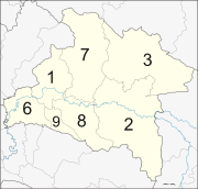
The missing numbers 4 and 5 as well as 10 to 12 are the districts split off to form Sa Kaeo Province.
Transport
Roads
The main road through Prachinburi is Route 319. While Route 319 does not lead directly to other major centers, along with Route 33 it leads to Nakhon Nayok, and along with Routes 314 and 304 it leads to Bangkok.
Rail
Prachinburi is served by the State Railway of Thailand's Eastern Line. Prachin Buri Railway Station, is the main railway station located 122 kilometres (76 mi) from Bangkok.
Economy
Tambon Hua Wa in Si Maha Phot District is the location of Rojana Industrial Park.[2] Among other tenants of the park, Honda Automobile (Thailand) has established a 17.2 billion baht plant there to manufacture sub-compact vehicles. The plant, opened in March 2016, has an initial production capacity of 60,000 vehicles per year. The plant is designed to build up to 120,000 vehicles per year.[3]
Health
The main hospital of Prachinburi Province is Chaophraya Abhaibhubejhr Hospital.
References
^ "1 Demographic, population and housing statistics; Number of Population from Registration by Age, Sex and Province: 2016". National Statistical Office (NSO). Retrieved 19 December 2017..mw-parser-output cite.citation{font-style:inherit}.mw-parser-output .citation q{quotes:"""""""'""'"}.mw-parser-output .citation .cs1-lock-free a{background:url("//upload.wikimedia.org/wikipedia/commons/thumb/6/65/Lock-green.svg/9px-Lock-green.svg.png")no-repeat;background-position:right .1em center}.mw-parser-output .citation .cs1-lock-limited a,.mw-parser-output .citation .cs1-lock-registration a{background:url("//upload.wikimedia.org/wikipedia/commons/thumb/d/d6/Lock-gray-alt-2.svg/9px-Lock-gray-alt-2.svg.png")no-repeat;background-position:right .1em center}.mw-parser-output .citation .cs1-lock-subscription a{background:url("//upload.wikimedia.org/wikipedia/commons/thumb/a/aa/Lock-red-alt-2.svg/9px-Lock-red-alt-2.svg.png")no-repeat;background-position:right .1em center}.mw-parser-output .cs1-subscription,.mw-parser-output .cs1-registration{color:#555}.mw-parser-output .cs1-subscription span,.mw-parser-output .cs1-registration span{border-bottom:1px dotted;cursor:help}.mw-parser-output .cs1-ws-icon a{background:url("//upload.wikimedia.org/wikipedia/commons/thumb/4/4c/Wikisource-logo.svg/12px-Wikisource-logo.svg.png")no-repeat;background-position:right .1em center}.mw-parser-output code.cs1-code{color:inherit;background:inherit;border:inherit;padding:inherit}.mw-parser-output .cs1-hidden-error{display:none;font-size:100%}.mw-parser-output .cs1-visible-error{font-size:100%}.mw-parser-output .cs1-maint{display:none;color:#33aa33;margin-left:0.3em}.mw-parser-output .cs1-subscription,.mw-parser-output .cs1-registration,.mw-parser-output .cs1-format{font-size:95%}.mw-parser-output .cs1-kern-left,.mw-parser-output .cs1-kern-wl-left{padding-left:0.2em}.mw-parser-output .cs1-kern-right,.mw-parser-output .cs1-kern-wl-right{padding-right:0.2em}
^ "Our Location". Rojana Industrial Park Public Co, Ltd. Retrieved 12 March 2016.
^ Maikaew, Piyachart (2016-03-12). "Prachin Buri plant to kick off". Bangkok Post. Retrieved 12 March 2016.
External links
 Prachinburi travel guide from Wikivoyage
- Provincial Website
Prachinburi from the Tourism Authority of Thailand- Khao Yai National Park
Places adjacent to Prachinburi Province | ||||||||||
|---|---|---|---|---|---|---|---|---|---|---|
| ||||||||||
| Wikimedia Commons has media related to Prachinburi Province. |
Coordinates: 14°2′52″N 101°22′21″E / 14.04778°N 101.37250°E / 14.04778; 101.37250


Comments
Post a Comment