Wielopole Skrzyńskie
Wielopole Skrzyńskie | |
|---|---|
Village | |
 | |
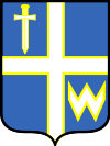
 Coat of arms | |
 Wielopole Skrzyńskie | |
| Coordinates: 49°57′N 21°37′E / 49.950°N 21.617°E / 49.950; 21.617 | |
| Country | |
| Voivodeship | Subcarpathian |
| County | Ropczyce-Sędziszów |
| Gmina | Wielopole Skrzyńskie |
| Population | 3,982 |
Wielopole Skrzyńskie [vjɛlɔˈpɔlɛ ˈskʂɨɲskʲɛ] is a village (town in 1348 - 1933) in Ropczyce-Sędziszów County, Subcarpathian Voivodeship, in south-eastern Poland. It is the seat of the gmina (administrative district) called Gmina Wielopole Skrzyńskie. It lies in historic Lesser Poland, approximately 16 kilometres (10 mi) south of Ropczyce and 30 km (19 mi) west of the regional capital Rzeszów.[1]Tadeusz Kantor, a Polish painter, assemblage artist, set designer and theatre director, was born in Wielopole. Another famous personality born here is Marcin Daniec, popular stand-up comedian.
On 11 May 1955, in a wooden shack fire during cinema projection, 58 people (including 36 children) perished,[2] the worst one-day death toll in Polish post-war history. This tragedy was commemorated by a monument, which stands in Wielopole’s market square.
The history of Wielopole dates back to the 12th century, when it was a defensive gord, located on a hill called Stroszowa Góra, among the forests near the border between Lesser Poland and Red Ruthenia. It was first mentioned in 1124, in a document of papal legate Gilles de Paris. In 1266 Ruthenian Prince Swarno, supported by Lithuanians and Tatars, raided eastern Lesser Poland, burning Wielopole to the ground. The village received Magdeburg rights in c. 1348, and at that time it was called Fuerstenberg, due to the fact that most of its inhabitants were the Walddeutsche. The town was located on a merchant route from Sandomierz, through Ropczyce, towards the Kingdom of Hungary, and until the late 14th century, it was property of the Bishopric of Lebus.
In 1325, Wielopole already had a parich church of St. Mary. The town remained in private hands; after the Bishopric of Lebus, its owners were the Kamieniecki family, the Frysztacki family (1492 - 1518), and the Maciejowski family. In the late 15th century, 111 families resided in Wielopole, with a few artisans. In the first half of the 16th century, town’s owner Kacper Maciejowski began to invest in Wielopole, building a Renaissance castle. The town however did not emerge as an important trade center. It belonged to Sandomierz Voivodeship, and its situation deteriorated after the Swedish invasion of Poland, when both Swedish and Transilvanian armies of George II Rakoczi burned and ransacked it. In the 18th century, Wielopole declined further, and following the Partitions of Poland, it found itself in Austrian Galicia.
By the early 19th century, half of Wielopole’s residents were Jewish. In 1806, an epidemic of cholera killed 92, and in 1833, Wielopole burned in a fire. During the Galician slaughter, a gang of peasants entered the castle, murdering several noblemen gathered there. In the mid-19th century, Wielopole belonged to Borgiasz de Zaręba Skrzyński, after whom the adjective Skrzyńskie was added to the name. It remained a small, provincial town, without rail transport, as Galician Railway of Archduke Charles Louis goes some 15 kilometers to the north.
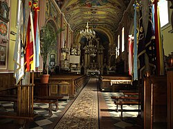
On September 24, 1914, Wielopole was captured by the Russian Imperial Army. The Russians retreated after two weeks, to return in October 1915. In May 1915, during the Gorlice–Tarnów Offensive, Wielopole was seized by the Austrians. World War I resulted in widespread destruction and poverty of local population. Wielopole did not recover in the Second Polish Republic, and in 1933, its town charter was taken away. Since then, it has been a village. Its Jewish population was murdered by Germans in the Holocaust, and in August 1944, the village was partially destroyed. Among points of interest there are: Baroque parish church (1683), with a bell tower, early 19th century roadside chapel in the market square, 19th century wooden houses, ruins of defensive wall, and cemeteries.
See also
- Walddeutsche
References
^ "Central Statistical Office (GUS) - TERYT (National Register of Territorial Land Apportionment Journal)" (in Polish). 2008-06-01..mw-parser-output cite.citation{font-style:inherit}.mw-parser-output .citation q{quotes:"""""""'""'"}.mw-parser-output .citation .cs1-lock-free a{background:url("//upload.wikimedia.org/wikipedia/commons/thumb/6/65/Lock-green.svg/9px-Lock-green.svg.png")no-repeat;background-position:right .1em center}.mw-parser-output .citation .cs1-lock-limited a,.mw-parser-output .citation .cs1-lock-registration a{background:url("//upload.wikimedia.org/wikipedia/commons/thumb/d/d6/Lock-gray-alt-2.svg/9px-Lock-gray-alt-2.svg.png")no-repeat;background-position:right .1em center}.mw-parser-output .citation .cs1-lock-subscription a{background:url("//upload.wikimedia.org/wikipedia/commons/thumb/a/aa/Lock-red-alt-2.svg/9px-Lock-red-alt-2.svg.png")no-repeat;background-position:right .1em center}.mw-parser-output .cs1-subscription,.mw-parser-output .cs1-registration{color:#555}.mw-parser-output .cs1-subscription span,.mw-parser-output .cs1-registration span{border-bottom:1px dotted;cursor:help}.mw-parser-output .cs1-ws-icon a{background:url("//upload.wikimedia.org/wikipedia/commons/thumb/4/4c/Wikisource-logo.svg/12px-Wikisource-logo.svg.png")no-repeat;background-position:right .1em center}.mw-parser-output code.cs1-code{color:inherit;background:inherit;border:inherit;padding:inherit}.mw-parser-output .cs1-hidden-error{display:none;font-size:100%}.mw-parser-output .cs1-visible-error{font-size:100%}.mw-parser-output .cs1-maint{display:none;color:#33aa33;margin-left:0.3em}.mw-parser-output .cs1-subscription,.mw-parser-output .cs1-registration,.mw-parser-output .cs1-format{font-size:95%}.mw-parser-output .cs1-kern-left,.mw-parser-output .cs1-kern-wl-left{padding-left:0.2em}.mw-parser-output .cs1-kern-right,.mw-parser-output .cs1-kern-wl-right{padding-right:0.2em}
^ http://ropczyce24.pl/index.php?option=content&task=view&id=522 ropczyce24.pl
External links
- http://ropczyce24.pl/index.php?option=content&task=view&id=522
Coordinates: 49°57′N 21°37′E / 49.950°N 21.617°E / 49.950; 21.617

Comments
Post a Comment