 Mixing
Lôh-Djiboua
Lôh-Djiboua Region Région du Lôh-Djiboua | |
|---|---|
Region | |
Seal | |
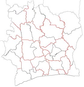
 Location of Lôh-Djiboua Region (green) in Ivory Coast and in Gôh-Djiboua District | |
| Country | |
| District | Gôh-Djiboua |
| 2011 | Established |
| Regional seat | Divo |
| Government [1][2] | |
| • Prefect | Joseph Kpan Droh |
| • Council President | Komenan Tchekoura Rolland Zakpa |
| Area | |
| • Total | 10,650 km2 (4,110 sq mi) |
| [3] | |
| Population (2014) | |
| • Total | 729,169 |
| • Density | 68/km2 (180/sq mi) |
| [4] | |
| Time zone | UTC+0 (GMT) |
| Website | lohdjiboua.org |
Lôh-Djiboua Region is one of the 31 regions of Ivory Coast. Since its creation in 2011, it has been one of two regions in Gôh-Djiboua District. The regional seat is Divo and the region's area is 10,650 km².[3] At the 2014 census, the region had a population of 729,169.[4]
History
Lôh-Djiboua Region was created as part of the 2011 reorganisation of the subdivisions of Ivory Coast. Prior to this, the territory that is now Lôh-Djiboua constituted the majority of the first-level division Sud-Bandama Region, which also included what is now Fresco Department. At the reorganisation, the territory of Fresco Department was transferred to Bas-Sassandra District and the remainder of Sud-Bandama became the second-level division Lôh-Djiboua. Lôh-Djiboua was combined with Gôh Region to form the new first-level division Gôh-Djiboua District.
Departments
Lôh-Djiboua is currently divided into three departments: Divo, Guitry, and Lakota.
Notes
^ "Préfets de Région et de Préfets de Département (Conseil des ministres du mercredi 26 septembre 2012)", abidjan.net, 2 October 2012.
^ "Conseil Régional du Lôh-Djiboua" Archived 2016-03-11 at the Wayback Machine, lohdjiboua.org, accessed 11 March 2016.
^ ab "Districts of Côte d'Ivoire (Ivory Coast)". Statoids.com. Retrieved 24 June 2015..mw-parser-output cite.citation{font-style:inherit}.mw-parser-output .citation q{quotes:"""""""'""'"}.mw-parser-output .citation .cs1-lock-free a{background:url("//upload.wikimedia.org/wikipedia/commons/thumb/6/65/Lock-green.svg/9px-Lock-green.svg.png")no-repeat;background-position:right .1em center}.mw-parser-output .citation .cs1-lock-limited a,.mw-parser-output .citation .cs1-lock-registration a{background:url("//upload.wikimedia.org/wikipedia/commons/thumb/d/d6/Lock-gray-alt-2.svg/9px-Lock-gray-alt-2.svg.png")no-repeat;background-position:right .1em center}.mw-parser-output .citation .cs1-lock-subscription a{background:url("//upload.wikimedia.org/wikipedia/commons/thumb/a/aa/Lock-red-alt-2.svg/9px-Lock-red-alt-2.svg.png")no-repeat;background-position:right .1em center}.mw-parser-output .cs1-subscription,.mw-parser-output .cs1-registration{color:#555}.mw-parser-output .cs1-subscription span,.mw-parser-output .cs1-registration span{border-bottom:1px dotted;cursor:help}.mw-parser-output .cs1-ws-icon a{background:url("//upload.wikimedia.org/wikipedia/commons/thumb/4/4c/Wikisource-logo.svg/12px-Wikisource-logo.svg.png")no-repeat;background-position:right .1em center}.mw-parser-output code.cs1-code{color:inherit;background:inherit;border:inherit;padding:inherit}.mw-parser-output .cs1-hidden-error{display:none;font-size:100%}.mw-parser-output .cs1-visible-error{font-size:100%}.mw-parser-output .cs1-maint{display:none;color:#33aa33;margin-left:0.3em}.mw-parser-output .cs1-subscription,.mw-parser-output .cs1-registration,.mw-parser-output .cs1-format{font-size:95%}.mw-parser-output .cs1-kern-left,.mw-parser-output .cs1-kern-wl-left{padding-left:0.2em}.mw-parser-output .cs1-kern-right,.mw-parser-output .cs1-kern-wl-right{padding-right:0.2em}
^ ab "Côte d'Ivoire". GeoHive.com. Archived from the original on 22 November 2015. Retrieved 24 June 2015.
| Bas-Sassandra District |
|  |
|---|---|---|
| Comoé District |
| |
| Denguélé District |
| |
| Gôh-Djiboua District |
| |
| Lacs District |
| |
| Lagunes District |
| |
| Montagnes District |
| |
| Sassandra-Marahoué District |
| |
| Savanes District |
| |
| Vallée du Bandama District |
| |
| Woroba District |
| |
| Zanzan District |
| |
Regional seat: Divo | ||
| Divo Department |
|  |
| Guitry Department |
| |
| Lakota Department |
| |
* also a commune | ||
Coordinates: 5°50′N 5°22′W / 5.833°N 5.367°W / 5.833; -5.367


Comments
Post a Comment