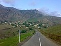
 Mixing
Germi County
Germi County شهرستان گرمی | |
|---|---|
County | |
 Location in Ardabil Province | |
 Location of Ardabil Province in Iran | |
| Coordinates: 39°00′N 47°57′E / 39.000°N 47.950°E / 39.000; 47.950Coordinates: 39°00′N 47°57′E / 39.000°N 47.950°E / 39.000; 47.950 | |
| Country | Iran |
| Province | Ardabil Province |
| Capital | Germi |
Bakhsh (Districts) | Central District, Anguti District, Muran District |
| Population (2017) | |
| • Total | 76'901 |
| • Density | 44.6/km2 (116/sq mi) |
| Time zone | UTC+3:30 (IRST) |
| • Summer (DST) | UTC+4:30 (IRDT) |
Germi County at GEOnet Names Server | |
Germi County (Persian: شهرستان گرمی) is a county in Ardabil Province in Iran. It is on the north of Ardabil city. The capital of the county is Germi.
The county is divided into three districts: Anguti District, the Central District, and Muran District. The county has two cities: Germi and Tazeh Kand-e Angut.
Germi, the capital of county, is located at 110 km (68 mi) from Ardabil, the capital of the province.
Contents
1 Appellation and etymology
2 History
2.1 First, many ancient era:
2.2 Second, Parthian and Sassanian era:
2.3 Third; From early years of entering Islam in Iran to Safavid dynasty:
2.4 Four: New age which returns to 1734 ad.
3 Climate and Geographical Issue
3.1 Precipitation, Springs, Rivers and Qanats
3.2 vegetation
4 People and Culture
5 Economy
5.1 Agriculture
5.2 Industry
6 References
7 External links
Appellation and etymology
When it comes to etymology of "Germi" it seems some how cryptic. The earliest book or document which has written about this area comes back to year 22 Hijri (about 671 Gregorian calendar) when Arab soldiers inter Aran or Alan region[1]. As it is believed before Islam era Alan's people were living in this area. Words such as Alania, Allan-shahr, Alan-shahr and Alan-shah had been used firstly at the first ad century for this district where was located between Azerbaijan, Shirvan, Caspian sea and Armenia. As it comes out from historical document many Alan people migrated from this area after Islamic era then firstly substitute by Muslim people from different ethnic groups. After that the area between those four borders was known as Mugan or Amukan and other pronunciation of them.
Many historians believe the word "Germi" has Parthian or Alanian stems. Many others suggest ritual words stem from religions such as Mithraism.
There is 2 theory that believe Germi is combination of 2 words: Ger and mi but the interpretation is different: One group believe on Sumerian stem that "Ger" means village and "Mi" means celestial the other believe "Ger" comes from "Ager" in old persian language that changed to "Akhgar" at new Persian language, whereas "mi" comes from "mehr" or "Mitra" which both means: "Sun", so "germi" means fireplace of sun. This interpretation is more consistent with other documents and evidences about region and its history.
History
History of county is closely related by history of Mugan region. The history of Mugan is divided into 4 era.
First, many ancient era:
There is enormous works from ancient period in this era but there is not a complete museum about the region. Most of the ancient monuments discovered from the region, irrespective of the historical period, are held in several museums such as Iran National Museum, Kashan museum and Copenhagen museum and several others.
Second, Parthian and Sassanian era:
There is several stunning works from this era such as daughter-castle in north of county, Langan Qantas, Barzand Castle.
Third; From early years of entering Islam in Iran to Safavid dynasty:
This era was not flourishing period for Mugan region and because of long period of wars there is not any sign of progress, buildings and outstanding monuments.The historical place in this county that had big value in this era is Barzand Castle that was the castle of Afshin who battled with Babak Khorramdin in an earlier century of Islamic history.
Four: New age which returns to 1734 ad.
Ignoring the earlier 3 historical periods that are the venue, Germi city is relatively new by Iranian standards; it was established about the year 900 of the Islamic calendar when Shah Ismael allowed five Shia families to migrate to this region. There were some other places and cities in Azerbaijan of I.R. Iran and Azerbaijan that are also called Germi.
Climate and Geographical Issue
The city's area is almost 1725 square kilometers. The altitude varies between 250 meters in the village of Khan Mohammad loo in the northwest up to 2200 meters in the southeast, which Salavat Mountains are located there.
The Moghan (Garmi) region, due to its specific topographic conditions, has a different climate with other parts of Azerbaijan and even its southern regions. County has almost Mediterranean climate.
Monsoon winds called Caspian Winds (Caspian Sea), which come from the Caspian Sea, greatly increase the cooling rate. The distance between the Moghan (Garmi) region and the Caspian Sea is about 80 to 90 km, but in general, considering the climatic division, this region can be considered as semi-arid because the annual rainfall is less than 500 mm. The warm summer heat It is wet and it has a moderate winter. The winters are usually accompanied by cold, frosty, and foggy winds. Average monthly temperature is of −1 to 31 °C (30 to 88 °F).[2]
Precipitation, Springs, Rivers and Qanats
The average yearly precipitation of county is 460 mm (18.1 in). It differs across the county: minimum precipitation is at north-west in Khan-Mohammad-loo village by 250 mm, whereas maximum rainfall is at Dash-dibi village at south-east by 700mm.
There are 69 permanent fountains in the city that puts it in the 4th rank of the province.[3]
The county has 7 permanent river but there But their watering varies between 10 million cubic meters to 1 billion cubic meters. The largest river of the county is Dareroud; The valley of the river originates from the slopes of Mount Sabalan and joins Aras river on the northern border of I.R. Iran passing through the counties of Ardabil, Meshkin-Shahr, Garmi and Bilesuvar and joining several rivers along the route. This river is the largest internal river of Ardabil province.
Balhary, Bulgary or Balharood is another important river of the county that forms part of its route, the border between Iran and Azerbaijan.[4]
vegetation
The range lands and forests of the city are scattered or densely populated with different types of plants, trees and shrubs among the varieties of elm, oak, figs, mountain plums, hawthorn, apple, barberry, raspberries, sweetbrier, tamarisk, pine species and a variety of medicinal plants such as licorice, Styphnolobium japonicum, Malva sylvestris, spearmint, Echium, chamomile, yarrow, saffron Mountain, wilted sorrel ,Rumex crispus, wild rue, Sorrel, Mountain tea and some other plants.
Iran has 3,400,000 hectares of national forest land, of which 5,000 hectares are located in this city, of which 3,000 are in the central part of the county and 2,000 in the Angoutian region.[5]
Tulips, lily of the valley, varieties of jasmine, gladiolus, violas and some other flowers grow up at the different seasons and in the different parts of the county.
People and Culture
At the 2017 census, the population of the county was 76901, in 22349 families. According to mentioned census, the population of the capital was 28967.[6]
Almost 100% People of this county are Shia Muslim and speak in Azeri. According to the book: "Investigating the Social Structure of Shahsavan Tribe" First time that Turk tribes entered to Mugan Returns to the era of Sultan Mahmud Ghaznavi successors in the fifth century. In the seventh century, the Tatar tribes overcome the Turkmens and threw them from the area.[7]
Economy
While trade was the most important reason for the emergence and development of the city of Garmi, The economy of Germi region is primarily based on agriculture and animal husbandry, then public services, government services and commerce.
Other services, as well as industry and mining, have a very small share in the region's economy.
According to national development standards Ardabil province is one of less-developed provinces and at this province Germi has 6th place of development.
Agriculture
Main agricultural product of county is cereals. All above mentioned conditions allow farmers to reach sufficient yields in growing cereals. Cereal Yield of exceeds from some provinces of Iran such as Yazd and Hormozgan. Just, wheat production of Germi is about 70000 metric tones to 140000 metric tones per year.[8][9]
Nectarine, pomegranate, peach,quince, apple, walnut, fig, cherry, sour cherry, plum, berry, blackberry, are the main fruits of the city. Main garden product of Germi is nectarine that exceeds 2,500 metric tons of yield per year, where whole Iran nectarine product exceeds 1.1 million tones, yet, Germi has the best hectare yield of nectarine by more than 40 tones per hectare.
Live animals, red meat, dairy products and poultry are among the other important products of region.
Industry
Germi has two state-approved industrial towns also there are some small or large factories out of industrial towns. Some building materials, as well as valves and some consumer goods, are the industrial production of the region. The production of valves is the most important part of industrial production in the city, and entrepreneurs are rapidly developing the valve industry in the city.


References
^ Yar Shater, Ehsan (1365 Hijri). Iran & Islam encyclopedia. Books Translating and Publishing firm (Bongah e tarjome va nashr ketab). Check date values in:|year=(help).mw-parser-output cite.citation{font-style:inherit}.mw-parser-output q{quotes:"""""""'""'"}.mw-parser-output code.cs1-code{color:inherit;background:inherit;border:inherit;padding:inherit}.mw-parser-output .cs1-lock-free a{background:url("//upload.wikimedia.org/wikipedia/commons/thumb/6/65/Lock-green.svg/9px-Lock-green.svg.png")no-repeat;background-position:right .1em center}.mw-parser-output .cs1-lock-limited a,.mw-parser-output .cs1-lock-registration a{background:url("//upload.wikimedia.org/wikipedia/commons/thumb/d/d6/Lock-gray-alt-2.svg/9px-Lock-gray-alt-2.svg.png")no-repeat;background-position:right .1em center}.mw-parser-output .cs1-lock-subscription a{background:url("//upload.wikimedia.org/wikipedia/commons/thumb/a/aa/Lock-red-alt-2.svg/9px-Lock-red-alt-2.svg.png")no-repeat;background-position:right .1em center}.mw-parser-output .cs1-subscription,.mw-parser-output .cs1-registration{color:#555}.mw-parser-output .cs1-subscription span,.mw-parser-output .cs1-registration span{border-bottom:1px dotted;cursor:help}.mw-parser-output .cs1-hidden-error{display:none;font-size:100%}.mw-parser-output .cs1-visible-error{font-size:100%}.mw-parser-output .cs1-subscription,.mw-parser-output .cs1-registration,.mw-parser-output .cs1-format{font-size:95%}.mw-parser-output .cs1-kern-left,.mw-parser-output .cs1-kern-wl-left{padding-left:0.2em}.mw-parser-output .cs1-kern-right,.mw-parser-output .cs1-kern-wl-right{padding-right:0.2em}
^ "Germi county environmental protection agency". 2018/12/10. Check date values in:|date=(help)
^ Organization of programming and budgeting of Ardabil province. Ardabil Province statistics book. Organization of programming and budgeting of Ardabil province.
^ "Wikipedia-Persian". 2018/10/12. Check date values in:|date=(help)
^ "Germi city information base".
^ https://www.amar.org.ir/%D8%B3%D8%B1%D8%B4%D9%85%D8%A7%D8%B1%DB%8C-%D8%B9%D9%85%D9%88%D9%85%DB%8C-%D9%86%D9%81%D9%88%D8%B3-%D9%88-%D9%85%D8%B3%DA%A9%D9%86/%D9%86%D8%AA%D8%A7%DB%8C%D8%AC-%D8%B3%D8%B1%D8%B4%D9%85%D8%A7%D8%B1%DB%8C
^ Ibn-e-Muhammad Ghazvini, Zakaria (7th century). Asar-o-lebad & Akhbar-o-lbelad. Check date values in:|year=(help)
^ Islamic Republic news Agency, IRNA. "میزان تولید محصول گندم شهرستان گرمی".
^ Tasnim News. "تولید گندم شهرستان گرمی".
- اطلس گیتاشناسی استانهای ایران [Atlas Gitashenasi Ostanhai Iran] (Gitashenasi Province Atlas of Iran)
External links
| Wikimedia Commons has media related to Germi county. |
| Capital |
|  | |||||||||||||||||||
|---|---|---|---|---|---|---|---|---|---|---|---|---|---|---|---|---|---|---|---|---|---|
Counties and cities |
| ||||||||||||||||||||
| Landmarks |
| ||||||||||||||||||||
| Places |
| ||||||||||||||||||||
| Capital |
| ||||||||||||||||||||||||||||||||||||
|---|---|---|---|---|---|---|---|---|---|---|---|---|---|---|---|---|---|---|---|---|---|---|---|---|---|---|---|---|---|---|---|---|---|---|---|---|---|
| Districts |
| ||||||||||||||||||||||||||||||||||||
This Germi County location article is a stub. You can help Wikipedia by expanding it. |


Comments
Post a Comment