 Mixing
Jessen (Elster)
Jessen | ||
|---|---|---|
 | ||
| ||
Location of Jessen (Elster) within Wittenberg district 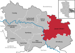 | ||
 Jessen Show map of Germany  Jessen Show map of Saxony-Anhalt | ||
| Coordinates: 51°47′30″N 12°57′20″E / 51.79167°N 12.95556°E / 51.79167; 12.95556Coordinates: 51°47′30″N 12°57′20″E / 51.79167°N 12.95556°E / 51.79167; 12.95556 | ||
| Country | Germany | |
| State | Saxony-Anhalt | |
| District | Wittenberg | |
| Government | ||
| • Mayor |
Michael Jahn (SPD) | |
| Area [1] | ||
| • Total | 352.12 km2 (135.95 sq mi) | |
| Elevation |
72 m (236 ft) | |
| Population (2017-12-31)[2] | ||
| • Total | 14,174 | |
| • Density | 40/km2 (100/sq mi) | |
| Time zone | CET/CEST (UTC+1/+2) |
|
| Postal codes | 06917, 06918, 06926, 06928 |
|
| Dialling codes | 03537, 035387, 035389 | |
| Vehicle registration | WB, GHC, JE | |
| Website | www.jessen.de | |

Jessen is a municipality on the Black Elster river and lies in the eastern part of Saxony-Anhalt in the district of Wittenberg.
Contents
1 Geography
2 History
3 Economy and infrastructure
4 Culture and Sightseeing
5 Personalities
6 Sundry
7 References
8 External links
Geography
Jessen is an amalgamated municipality, and has the following subdivisions:
|
|
|
History
The first documentary evidence of Jessen's existence dates to 1217. On the night of 20 to 21 September 1729, much of the town was destroyed in a fire. After belonging to Saxony for centuries, Jessen became Prussian in 1816.
In 1945, it became part of the state of Saxony-Anhalt. In 1952, owing to East German administrative reforms, Jessen became a district capital in the Cottbus region (Cottbus is nowadays in Brandenburg). In 1990, Jessen once again became part of the newly-refounded state of Saxony-Anhalt. In 1992 came the amalgamation of the communities of Grabo, Gorsdorf-Hemsendorf, Lindwerder and Großkorga, and in 1993, Schweinitz, Gerbisbach, Klossa, Schöneicho, Steinsdorf and Dixförda. With the district reform in 1994, Jessen became part of Wittenberg district, as well as having a further three communities melded with it, namely Battin, Düßnitz and Kleindröben-Mauken. In 1999 came further amalgamations: Arnsdorf, Leipa and Ruhlsdorf mit Rehain. On 1 March 2004 came a further 12, among them Seyda, Holzdorf and Linda (Elster). Some of these formerly independent communities themselves each consisted of more than one centre, and so Jessen now has a total of 47 Stadtteile (constituent communities).
Economy and infrastructure
Established businesses are mostly small and mid-sized concerns in metalworking, building, dairy processing and drink production. There are also, however, bigger enterprises in agriculture.
Culture and Sightseeing

Church
- Historic marketplace in Jessen
- Parish church of St. Nicolai in Jessen
- Schloss Jessen (stately home), since 1999 town council seat
- Parish church of St. Marien in Schweinitz
Amtshaus in Schweinitz- Gorsdorf village church
- Kleindröben village church
- Pretzsch-Mauken reaction ferry
Personalities
Karl Lamprecht (25 February 1856 – 10 May 1915 in Leipzig), was Professor of History at the University of Leipzig, who is known today mainly for his rôle in the Methodenstreit.
Herbert Kaiser (16 March 1916 – 5 December 2003) a pilot in the Luftwaffe during World War II
Sundry
The town is Germany's twelfth-largest municipality by land area, and is thereby about 3 km² bigger than Munich.
References
^ "Alle politisch selbständigen Gemeinden mit ausgewählten Merkmalen am 31.12.2018 (4. Quartal)". DESTATIS. Archived from the original on 10 March 2019. Retrieved 10 March 2019..mw-parser-output cite.citation{font-style:inherit}.mw-parser-output .citation q{quotes:"""""""'""'"}.mw-parser-output .citation .cs1-lock-free a{background:url("//upload.wikimedia.org/wikipedia/commons/thumb/6/65/Lock-green.svg/9px-Lock-green.svg.png")no-repeat;background-position:right .1em center}.mw-parser-output .citation .cs1-lock-limited a,.mw-parser-output .citation .cs1-lock-registration a{background:url("//upload.wikimedia.org/wikipedia/commons/thumb/d/d6/Lock-gray-alt-2.svg/9px-Lock-gray-alt-2.svg.png")no-repeat;background-position:right .1em center}.mw-parser-output .citation .cs1-lock-subscription a{background:url("//upload.wikimedia.org/wikipedia/commons/thumb/a/aa/Lock-red-alt-2.svg/9px-Lock-red-alt-2.svg.png")no-repeat;background-position:right .1em center}.mw-parser-output .cs1-subscription,.mw-parser-output .cs1-registration{color:#555}.mw-parser-output .cs1-subscription span,.mw-parser-output .cs1-registration span{border-bottom:1px dotted;cursor:help}.mw-parser-output .cs1-ws-icon a{background:url("//upload.wikimedia.org/wikipedia/commons/thumb/4/4c/Wikisource-logo.svg/12px-Wikisource-logo.svg.png")no-repeat;background-position:right .1em center}.mw-parser-output code.cs1-code{color:inherit;background:inherit;border:inherit;padding:inherit}.mw-parser-output .cs1-hidden-error{display:none;font-size:100%}.mw-parser-output .cs1-visible-error{font-size:100%}.mw-parser-output .cs1-maint{display:none;color:#33aa33;margin-left:0.3em}.mw-parser-output .cs1-subscription,.mw-parser-output .cs1-registration,.mw-parser-output .cs1-format{font-size:95%}.mw-parser-output .cs1-kern-left,.mw-parser-output .cs1-kern-wl-left{padding-left:0.2em}.mw-parser-output .cs1-kern-right,.mw-parser-output .cs1-kern-wl-right{padding-right:0.2em}
^ "Bevölkerung der Gemeinden – Stand: 31. Dezember 2017" (PDF). Statistisches Landesamt Sachsen-Anhalt (in German).
External links
| Wikimedia Commons has media related to Jessen (Elster). |
- Jessen
Towns and municipalities in the district of Wittenberg | ||
|---|---|---|
|
||
Authority control |
|
|---|


Comments
Post a Comment