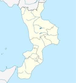
Isca sullo Ionio
Isca sullo Ionio | |
|---|---|
Comune | |
| Comune di Isca sullo Ionio | |
Location of Isca sullo Ionio | |
 Isca sullo Ionio Location of Isca sullo Ionio in Italy Show map of Italy  Isca sullo Ionio Isca sullo Ionio (Calabria) Show map of Calabria | |
| Coordinates: 38°36′N 16°31′E / 38.600°N 16.517°E / 38.600; 16.517Coordinates: 38°36′N 16°31′E / 38.600°N 16.517°E / 38.600; 16.517 | |
| Country | Italy |
| Region | Calabria |
| Province | Catanzaro (CZ) |
| Area [1] | |
| • Total | 23.56 km2 (9.10 sq mi) |
| Elevation |
188 m (617 ft) |
| Population (2018-01-01)[2] | |
| • Total | 1,603 |
| • Density | 68/km2 (180/sq mi) |
| Demonym(s) | Iscani |
| Time zone | UTC+1 (CET) |
| • Summer (DST) | UTC+2 (CEST) |
| Dialing code | 0967 |
| Patron saint | St. Martialis |
| Saint day | July 10 |
| Website | Official website |
Isca sullo Ionio (Calabrian: Jìsca; Greek: Iskia) is a comune and town in the province of Catanzaro in the Calabria region of Italy.
Contents
1 History
2 Earthquakes
3 Isca Marina
4 Sources
History
Isca is of Greek origin and as legend states the original name of the town was Sanagasi. The original town was located near the sea, probably about where Isca Marina is located today. It has been said that the original location was abandoned, due to the incursions of outsiders. Sometime, probably during the 9th Century, the inhabitants moved to higher ground, where present day Isca is today, perched between two mountains, with a wide clear view of the sea. The high open view of the sea offered protection for the people, giving them time to prepare for a possible
attack. The mountains that surround Isca on three sides, also made it difficult for outsiders to enter Isca from anywhere except from the shoreline. With a warm summer climate, the area is known for growing lemons, oranges, figs, chestnuts, grapes and beans.
Earthquakes
- November 5, 1659: A violent earthquake struck the town at about midnight. It killed 14 people.
- February 5, 1783: A devastating earthquake rocked Calabria, with 331 people perishing in a nearby town of Borgia. Isca was spared of any loss of life. The churches of Isca were heavily damaged.
- September 8, 1905: Isca had no loss of life. The epicenter was located near the Gulf of Saint Euphemia.
- December 28, 1908: This historic earthquake killed 65,000 people in Messina, Sicily and 25,000 in the Province of Reggio Calabria.
- May 11, 1947: This earthquake struck at 7:30 am. In terms of property loss it was the most devastating earthquake in the town's history. Three hundred homes were destroyed, as were the churches. Hundreds of families were left homeless. Only two people died, a 73-year-old and an 8-year-old. Though it is not the month in which he is celebrated, every year in May Isca honors San Marziale in remembrance of the historic day and to give thanks to their patron and protector.
Isca Marina
In the immediate days following the earthquake of 1947, talks began and planning of a new community or extension to Isca, that should be built on safer flat ground, near the beach. The name for the new community, would be called Isca Marina. Nine centuries earlier, the area now known as Isca Marina, was the original town location for the ancestors of Isca, until invasions of outsiders, forced the towns people, to higher ground. Now
many hundreds of descendants of the original town location have come home. While some homes were built in the late 1940s in the marina, it was not until the early 1950s that roads, sidewalks, and the town square were built. A water supply was established in 1951. Electricity reached the town in 1953. The elementary school was completed for the scholastic year 1956–57. Functional public lighting was completed in 1958. In the years to follow, Isca Marina would become a popular vacation destination for Italian and foreign travelers, on summer holiday.
Sources
^ "Superficie di Comuni Province e Regioni italiane al 9 ottobre 2011". Istat. Retrieved 16 March 2019..mw-parser-output cite.citation{font-style:inherit}.mw-parser-output .citation q{quotes:"""""""'""'"}.mw-parser-output .citation .cs1-lock-free a{background:url("//upload.wikimedia.org/wikipedia/commons/thumb/6/65/Lock-green.svg/9px-Lock-green.svg.png")no-repeat;background-position:right .1em center}.mw-parser-output .citation .cs1-lock-limited a,.mw-parser-output .citation .cs1-lock-registration a{background:url("//upload.wikimedia.org/wikipedia/commons/thumb/d/d6/Lock-gray-alt-2.svg/9px-Lock-gray-alt-2.svg.png")no-repeat;background-position:right .1em center}.mw-parser-output .citation .cs1-lock-subscription a{background:url("//upload.wikimedia.org/wikipedia/commons/thumb/a/aa/Lock-red-alt-2.svg/9px-Lock-red-alt-2.svg.png")no-repeat;background-position:right .1em center}.mw-parser-output .cs1-subscription,.mw-parser-output .cs1-registration{color:#555}.mw-parser-output .cs1-subscription span,.mw-parser-output .cs1-registration span{border-bottom:1px dotted;cursor:help}.mw-parser-output .cs1-ws-icon a{background:url("//upload.wikimedia.org/wikipedia/commons/thumb/4/4c/Wikisource-logo.svg/12px-Wikisource-logo.svg.png")no-repeat;background-position:right .1em center}.mw-parser-output code.cs1-code{color:inherit;background:inherit;border:inherit;padding:inherit}.mw-parser-output .cs1-hidden-error{display:none;font-size:100%}.mw-parser-output .cs1-visible-error{font-size:100%}.mw-parser-output .cs1-maint{display:none;color:#33aa33;margin-left:0.3em}.mw-parser-output .cs1-subscription,.mw-parser-output .cs1-registration,.mw-parser-output .cs1-format{font-size:95%}.mw-parser-output .cs1-kern-left,.mw-parser-output .cs1-kern-wl-left{padding-left:0.2em}.mw-parser-output .cs1-kern-right,.mw-parser-output .cs1-kern-wl-right{padding-right:0.2em}
^ "Popolazione Residente al 1° Gennaio 2018". Istat. Retrieved 16 March 2019.
^ "The World Gazetteer". Archived from the original on February 10, 2013. Retrieved 2014-02-24.
This Calabrian location article is a stub. You can help Wikipedia by expanding it. |


Comments
Post a Comment