 Mixing
Poznań County
Poznań County Powiat poznański | |||
|---|---|---|---|
County | |||
| |||
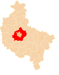 Location within the voivodeship | |||
| Coordinates (Poznań): 52°24′N 16°55′E / 52.400°N 16.917°E / 52.400; 16.917Coordinates: 52°24′N 16°55′E / 52.400°N 16.917°E / 52.400; 16.917 | |||
| Country | |||
| Voivodeship | |||
| Seat | Poznań | ||
| Gminas | Total 17 (incl. 2 urban)
|
||
| Area | |||
| • Total | 1,899.61 km2 (733.44 sq mi) | ||
| Population (2012) | |||
| • Total | 341 357 | ||
| • Urban |
132,048 | ||
| • Rural |
209,309 | ||
| Car plates | POZ, PZ | ||
| Website | http://www.powiat.poznan.pl | ||

Poznań County (Polish: powiat poznański) is a unit of territorial administration and local government (powiat) in Greater Poland Voivodeship, west-central Poland. It came into being on January 1, 1999, as a result of the Polish local government reforms passed in 1998. Its administrative seat is the city of Poznań, although the city is not part of the county (it constitutes a separate city county). The county's administrative offices (starostwo powiatowe) are in the Jeżyce neighbourhood of Poznań.
Poznań County contains 10 towns: Swarzędz, 11 km (7 mi) east of (central) Poznań, Luboń, 8 km (5 mi) south of Poznań, Mosina, 18 km (11 mi) south of Poznań, Murowana Goślina, 20 km (12 mi) north of Poznań, Puszczykowo, 14 km (9 mi) south of Poznań, Kostrzyn, 21 km (13 mi) east of Poznań, Pobiedziska, 27 km (17 mi) north-east of Poznań, Kórnik, 22 km (14 mi) south-east of Poznań, Buk, 28 km (17 mi) west of Poznań, and Stęszew, 21 km (13 mi) south-west of Poznań.
The county covers an area of 1,899.61 square kilometres (733.4 sq mi). As of 2012 its total population is 341.357, out of which the urban population is 132,048 (Swarzędz 29,894, Luboń 26,935, Mosina 12,150, Murowana Goślina 10,140, Puszczykowo 9,311, Kostrzyn 8,539, Pobiedziska 8,329, Kórnik 6,981, Buk 6,181, Stęszew 5,339), and the rural population is 209,309.
Neighbouring counties
Apart from the city of Poznań, Poznań County is also bordered by Oborniki County and Wągrowiec County to the north, Gniezno County and Września County to the east, Środa Wielkopolska County to the south-east, Śrem County and Kościan County to the south, Grodzisk Wielkopolski County and Nowy Tomyśl County to the west, and Szamotuły County to the north-west.
Administrative division
The county is subdivided into 17 gminas (two urban, eight urban-rural and seven rural). These are listed in the following table, in descending order of population.
| Gmina |
Type |
Area (km²) |
Population (2006) |
Seat |
|---|---|---|---|---|
Gmina Swarzędz |
urban-rural |
102.0 |
40,499 |
Swarzędz |
Luboń |
urban |
13.5 |
26,935 |
|
Gmina Mosina |
urban-rural |
170.9 |
25,098 |
Mosina |
Gmina Czerwonak |
rural |
82.2 |
23,692 |
Czerwonak |
Gmina Tarnowo Podgórne |
rural |
101.4 |
18,690 |
Tarnowo Podgórne |
Gmina Kórnik |
urban-rural |
186.6 |
17,585 |
Kórnik |
Gmina Pobiedziska |
urban-rural |
189.3 |
16,382 |
Pobiedziska |
Gmina Murowana Goślina |
urban-rural |
172.1 |
15,766 |
Murowana Goślina |
Gmina Kostrzyn |
urban-rural |
154.0 |
15,456 |
Kostrzyn |
Gmina Komorniki |
rural |
66.6 |
14,353 |
Komorniki |
Gmina Stęszew |
urban-rural |
175.2 |
13,919 |
Stęszew |
Gmina Dopiewo |
rural |
108.1 |
13,889 |
Dopiewo |
Gmina Suchy Las |
rural |
116.6 |
13,219 |
Suchy Las |
Gmina Buk |
urban-rural |
90.3 |
11,917 |
Buk |
Gmina Rokietnica |
rural |
79.3 |
9,415 |
Rokietnica |
Puszczykowo |
urban |
16.7 |
9,311 |
|
Gmina Kleszczewo |
rural |
74.8 |
5,436 |
Kleszczewo |
Demographics
| Historical population | ||
|---|---|---|
| Year | Pop. | ±% |
| 1995 | 240,708 | — |
| 1998 | 248,672 | +3.3% |
| 2001 | 264,855 | +6.5% |
| 2004 | 280,924 | +6.1% |
| 2007 | 303,595 | +8.1% |
| 2010 | 327,110 | +7.7% |
| 2013 | 352,395 | +7.7% |
| 2015 | 366,097 | +3.9% |
| 2016 | 373,570 | +2.0% |
| 2017 | 381,630 | +2.2% |
| Note: 2010[1] 2014[2] 2017[3] | ||
Map

A map of Poznań County. The pink lines indicate the boundaries of towns and gminas.
References
^ "Ludność w gminach. Stan w dniu 31 marca 2011 r. – wyniki spisu ludności i mieszkań 2011 r." Główny Urząd Statystyczny. Archived from the original on 27 November 2011. Retrieved 20 August 2012..mw-parser-output cite.citation{font-style:inherit}.mw-parser-output q{quotes:"""""""'""'"}.mw-parser-output code.cs1-code{color:inherit;background:inherit;border:inherit;padding:inherit}.mw-parser-output .cs1-lock-free a{background:url("//upload.wikimedia.org/wikipedia/commons/thumb/6/65/Lock-green.svg/9px-Lock-green.svg.png")no-repeat;background-position:right .1em center}.mw-parser-output .cs1-lock-limited a,.mw-parser-output .cs1-lock-registration a{background:url("//upload.wikimedia.org/wikipedia/commons/thumb/d/d6/Lock-gray-alt-2.svg/9px-Lock-gray-alt-2.svg.png")no-repeat;background-position:right .1em center}.mw-parser-output .cs1-lock-subscription a{background:url("//upload.wikimedia.org/wikipedia/commons/thumb/a/aa/Lock-red-alt-2.svg/9px-Lock-red-alt-2.svg.png")no-repeat;background-position:right .1em center}.mw-parser-output .cs1-subscription,.mw-parser-output .cs1-registration{color:#555}.mw-parser-output .cs1-subscription span,.mw-parser-output .cs1-registration span{border-bottom:1px dotted;cursor:help}.mw-parser-output .cs1-hidden-error{display:none;font-size:100%}.mw-parser-output .cs1-visible-error{font-size:100%}.mw-parser-output .cs1-subscription,.mw-parser-output .cs1-registration,.mw-parser-output .cs1-format{font-size:95%}.mw-parser-output .cs1-kern-left,.mw-parser-output .cs1-kern-wl-left{padding-left:0.2em}.mw-parser-output .cs1-kern-right,.mw-parser-output .cs1-kern-wl-right{padding-right:0.2em}
^ "Population in Poland. Size and structure by territorial division as of December 31, 2015" (ASPX) (in Polish). Retrieved 26 May 2016.
^ o.o., StayPoland Sp. z. "History of Rzeszow". Retrieved 28 April 2017.
- Polish official population figures 2006
Poznań County | ||
|---|---|---|
Seat: Poznań (not part of the county) | ||
| Urban gminas |
|
 |
| Urban-rural gminas |
|
|
| Rural gminas |
|
|
Counties of Greater Poland Voivodeship | ||
|---|---|---|
| City counties |
|
 |
| Land counties |
|
|


Comments
Post a Comment