 Mixing
Ashley, Pennsylvania
Ashley, Pennsylvania | |
|---|---|
Borough | |
 The Wells Block (including the Post Office) in Ashley | |
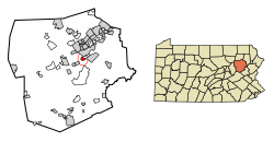 Location of Ashley in Luzerne County, Pennsylvania. | |
 Ashley Location of Ashley in Luzerne County, Pennsylvania. Show map of Pennsylvania  Ashley Ashley (the US) Show map of the US | |
| Coordinates: 41°12′51″N 75°53′58″W / 41.21417°N 75.89944°W / 41.21417; -75.89944Coordinates: 41°12′51″N 75°53′58″W / 41.21417°N 75.89944°W / 41.21417; -75.89944 | |
| Country | United States |
| State | Pennsylvania |
| County | Luzerne |
| Settled | 1830 |
| Incorporated (borough) | 1870 |
| Government | |
| • Type | Borough Council |
| • Mayor | Dave Evans |
| Area [1] | |
| • Total | 0.92 sq mi (2.39 km2) |
| • Land | 0.92 sq mi (2.39 km2) |
| • Water | 0.00 sq mi (0.00 km2) |
| Elevation | 627 ft (191 m) |
| Population (2010) | |
| • Total | 2,790 |
| • Estimate (2016)[2] | 2,705 |
| • Density | 2,927.49/sq mi (1,129.85/km2) |
| Time zone | UTC-5 (Eastern (EST)) |
| • Summer (DST) | UTC-4 (EDT) |
| Zip code | 18706 |
| Area code(s) | 570 |
| FIPS code | 42-03272 |
Ashley is a borough in Luzerne County, Pennsylvania, one mile (2 km) from Wilkes Barre. The population was 2,790 at the 2010 census.
Contents
1 History
2 Geography
2.1 Transportation
3 Demographics
4 Notable people
5 References
History
Ashley was first settled in 1830. Forty years later, in 1870, it was incorporated as a borough. It was a productive coal mining town well into the twentieth century, reaching its peak population of 7,039 in 1930. The Huber Breaker, built in 1939 to process coal from several local collieries, ceased operating in 1976, and was demolished in 2014.[3]
Geography

Huber Breaker in Ashley Borough
Ashley is located at 41°12′51″N 75°53′58″W / 41.21417°N 75.89944°W / 41.21417; -75.89944 (41.214182, -75.899387).[4]
According to the United States Census Bureau, the borough has a total area of 0.9 square miles (2.3 km2), all of it land. Most of the homes and businesses are located in the northern and western sections of Ashley. Hanover Township encircles the borough. Ashley is served by the Hanover Area School District.
Transportation
Interstate 81 and Pennsylvania Route 309 run through the eastern and southern portions of the town.
Demographics
| Historical population | |||
|---|---|---|---|
| Census | Pop. | %± | |
| 1880 | 2,799 | — | |
| 1890 | 3,192 | 14.0% | |
| 1900 | 4,046 | 26.8% | |
| 1910 | 5,601 | 38.4% | |
| 1920 | 6,520 | 16.4% | |
| 1930 | 7,093 | 8.8% | |
| 1940 | 6,371 | −10.2% | |
| 1950 | 5,243 | −17.7% | |
| 1960 | 4,258 | −18.8% | |
| 1970 | 4,095 | −3.8% | |
| 1980 | 3,512 | −14.2% | |
| 1990 | 3,291 | −6.3% | |
| 2000 | 2,866 | −12.9% | |
| 2010 | 2,790 | −2.7% | |
| Est. 2016 | 2,705 | [2] | −3.0% |
| Sources:[5][6] | |||
As of the census[7] of 2000, there were 2,866 people, 1,245 households, and 783 families residing in the borough. The population density was 3,105.2 people per square mile (1,202.8/km2). There were 1,386 housing units at an average density of 1,501.7 per square mile (581.7/km2). The racial makeup of the borough was 98.46% White, 0.38% African American, 0.03% Native American, 0.24% Asian, 0.10% from other races, and 0.77% from two or more races. Hispanic or Latino of any race were 0.42% of the population.
There were 1,245 households, out of which 25.4% had children under the age of 18 living with them, 43.1% were married couples living together, 14.4% had a female householder with no husband present, and 37.1% were non-families. 33.4% of all households were made up of individuals, and 16.4% had someone living alone who was 65 years of age or older. The average household size was 2.30 and the average family size was 2.94.
In the borough the population was spread out, with 21.5% under the age of 18, 7.5% from 18 to 24, 27.9% from 25 to 44, 23.6% from 45 to 64, and 19.4% who were 65 years of age or older. The median age was 40 years. For every 100 females there were 87.4 males. For every 100 females age 18 and over, there were 83.3 males.
The median income for a household in the borough was $30,592, and the median income for a family was $37,266. Males had a median income of $32,083 versus $20,378 for females. The per capita income for the borough was $17,676. About 8.8% of families and 10.6% of the population were below the poverty line, including 22.0% of those under age 18 and 9.6% of those age 65 or over.
Since the census of 2000 there has been a -5.9% population change resulting in a total population of 2,684 consisting of 1,252 males and 1,432 females as of July 2007. The population density is 2,908 people per square mile. The current racial makeup is primarily white, non-Hispanic with a 98.2%. The median resident age is 40.1 years. The estimated median household income is $37,869.[8]
Notable people
Eusebius J. Beltran, Archbishop of Roman Catholic Archdiocese of Oklahoma City
Thomas Chrostwaite, educator
Russell Johnson, actor, including It Came from Outer Space (1953) and This Island Earth (1955); best known to audiences as "The Professor" on Gilligan's Island TV series
John Morgan, the Oliver Williamson Professor of the Economics of Organizations, Haas School of Business, University of California (Berkeley)
Walter Tewksbury, won two gold medals in the 200 m sprint and 400 m hurdles at the 1900 Olympics
References
^ "2016 U.S. Gazetteer Files". United States Census Bureau. Retrieved Aug 14, 2017..mw-parser-output cite.citation{font-style:inherit}.mw-parser-output q{quotes:"""""""'""'"}.mw-parser-output code.cs1-code{color:inherit;background:inherit;border:inherit;padding:inherit}.mw-parser-output .cs1-lock-free a{background:url("//upload.wikimedia.org/wikipedia/commons/thumb/6/65/Lock-green.svg/9px-Lock-green.svg.png")no-repeat;background-position:right .1em center}.mw-parser-output .cs1-lock-limited a,.mw-parser-output .cs1-lock-registration a{background:url("//upload.wikimedia.org/wikipedia/commons/thumb/d/d6/Lock-gray-alt-2.svg/9px-Lock-gray-alt-2.svg.png")no-repeat;background-position:right .1em center}.mw-parser-output .cs1-lock-subscription a{background:url("//upload.wikimedia.org/wikipedia/commons/thumb/a/aa/Lock-red-alt-2.svg/9px-Lock-red-alt-2.svg.png")no-repeat;background-position:right .1em center}.mw-parser-output .cs1-subscription,.mw-parser-output .cs1-registration{color:#555}.mw-parser-output .cs1-subscription span,.mw-parser-output .cs1-registration span{border-bottom:1px dotted;cursor:help}.mw-parser-output .cs1-hidden-error{display:none;font-size:100%}.mw-parser-output .cs1-visible-error{font-size:100%}.mw-parser-output .cs1-subscription,.mw-parser-output .cs1-registration,.mw-parser-output .cs1-format{font-size:95%}.mw-parser-output .cs1-kern-left,.mw-parser-output .cs1-kern-wl-left{padding-left:0.2em}.mw-parser-output .cs1-kern-right,.mw-parser-output .cs1-kern-wl-right{padding-right:0.2em}
^ ab "Population and Housing Unit Estimates". Retrieved June 9, 2017.
^ http://www.huberbreaker.org/index.html Retrieved 2009-04-20.
^ "US Gazetteer files: 2010, 2000, and 1990". United States Census Bureau. 2011-02-12. Retrieved 2011-04-23.
^ "Census of Population and Housing: Decennial Censuses". United States Census Bureau. Archived from the original on 2006-02-08. Retrieved 2012-03-04.
^ "Incorporated Places and Minor Civil Divisions Datasets: Subcounty Resident Population Estimates: April 1, 2010 to July 1, 2012". Population Estimates. U.S. Census Bureau. Archived from the original on 17 June 2013. Retrieved 11 December 2013.
^ "American FactFinder". United States Census Bureau. Archived from the original on 2013-09-11. Retrieved 2008-01-31.
^ http://www.city-data.com/city/Ashley-Pennsylvania.html Retrieved 2009-03-13.
Municipalities and communities of Luzerne County, Pennsylvania, United States | ||
|---|---|---|
County seat: Wilkes-Barre | ||
| Cities |
|  |
| Boroughs |
| |
| Townships |
| |
| CDPs |
| |
| Unincorporated communities |
| |
| Footnotes | ‡This populated place also has portions in an adjacent county or counties | |


Comments
Post a Comment