 Mixing
Abia State
Abia | |||
|---|---|---|---|
State | |||
| Abia State | |||
 Abia Tower in Umuahia | |||
| |||
| Nicknames: God's Own State Igbo:Ọ̀hà Chineke | |||
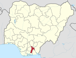 Location of Abia State in Nigeria | |||
| Coordinates: 5°25′N 7°30′E / 5.417°N 7.500°E / 5.417; 7.500Coordinates: 5°25′N 7°30′E / 5.417°N 7.500°E / 5.417; 7.500 | |||
| Country | |||
| Date created | 27 August 1991 | ||
| Capital | Umuahia | ||
| Government | |||
| • Governor[1] |
Okezie Ikpeazu (PDP) |
||
| • Deputy Governor | Ude Oko Chukwu (PDP) |
||
| • Senators |
Enyinnaya Abaribe Theodore Orji Mao Ohuabunwa |
||
| • Representatives |
List | ||
| Area | |||
| • Total | 6,320 km2 (2,440 sq mi) | ||
| Population (2006 census)[2] | |||
| • Total | 2,845,380 | ||
| • Density | 450/km2 (1,200/sq mi) | ||
| Demonym(s) | Abians | ||
GDP (PPP) | |||
| • Year | 2007 | ||
| • Total | $18.69 billion[3] |
||
| • Per capita | $3,003[3] |
||
| Time zone | UTC+01 (WAT) |
||
| ISO 3166 code | NG-AB | ||
| Official language | English | ||
| Website | abiastate.gov.ng | ||


Abia is a state in the south eastern part of Nigeria.[4] The capital is Umuahia and the major commercial city is Aba, which was formerly a British colonial government outpost in the region. Abia state was created in 1991 from part of Imo State.[5] It is one of the constituent states of the Niger Delta region.[4]
Contents
1 Geography
2 Infrastructure and economy
2.1 Oil and gas exploration
3 University and colleges
4 Travel
5 History and population
6 Politics
7 Local Government Areas
7.1 Traditional rulers
8 References
9 External links
Geography
Abia State, which occupies about 6,320 square kilometres, is bounded on the north and northeast by the states of Anambra, Enugu, and Ebonyi. To the west of Abia is Imo State, to the east and southeast are Cross River State and Akwa Ibom State respectively and to the south is Rivers State. The southern part of the State lies within the riverine part of Nigeria, it is a low-lying tropical rainforest with some oil-palm brush,[5] the southern portion gets heavy rainfall of about 2,400 millimetres (94 in) per year and is especially intense between the months of April through October. The rest of the State is moderately high plain and wooded savanna.[5] The most important rivers in Abia State are the Imo and Aba Rivers which flow into the Atlantic Ocean through Akwa Ibom State.
Infrastructure and economy
Crude oil and gas production is a prominent activity, as it contributes over 39% of the State's GDP.[6] However, the indigenous oil companies- through the Marginal Fields Programme (MFP)- have not found it easy to attract the requisite funding and infrastructural capacity to explore some of the marginal oil fields which are about 50 in the State.[7]
The manufacturing sector only accounts for 2% of the GDP.[6] The industrial centre of the state is in Aba, with textile manufacturing, pharmaceuticals, soap, plastics, cement, footwear, and cosmetics.[5] In addition to the above, Abia State Government has just built a 9,000 capacity multipurpose International Conference Centre in Umuahia. This edifice of international standard was built by Governor T.A Orji to enhance tourism as well as boost the state economy through hosting of major International and Local events.
Representing 27% of the GDP,[6] agriculture- which employs 70%[6] of the state workforce- is the second economic sector of Abia. With its adequate seasonal rainfall, Abia has much arable land that produces yams, maize, potatoes, rice, cashews, plantains, taro, and cassava.[5]Oil palm is the most important cash crop.[5]
Oil and gas exploration
There are over 100 oil wells and 3 installed flow stations in Abia State.[7][8] There is also an associated gas plant, Abia/NNPC gas plant.[8] As of 2012, boundary Commission said it returned 42 oil wells from neighbouring Rivers State to Abia.[8] This would have meant Abia being fourth largest oil producing state in the country.[8] Oil giant, Shell, holds most of the licenses for the wells in the State and has concentrated on the estimated 50 wells that are considered high-yield.[7]
The State produced 36,000 barrels of crude oil per day; "Imoturu produces 23,000 barrels per day and Isimili flow station produces over 8,000 barrels of crude oil per day. Then four oil wells in Izaku go to Obigo flow station. About 30 oil wells from my village go to Umuri and about eight oil wells from Umurie go to Afam", lamented Samuel Okezie Nwogu, Chairman of Abia State Oil Producing Development Area Commission (ASOPADEC).
However, the State has complained of poor funding from its oil revenue federal allocation. Our people are really suffering, and there are lots of projects we can still execute to alleviate their sufferings.[8]
University and colleges
There are four universities in the state: the federal-owned Michael Okpara University of Agriculture at Umudike, the state-owned Abia State University in Uturu, the Gregory University Uturu (privately owned) and Rhema University in Aba also (privately owned). There are two tertiary hospitals, the Federal Medical Center in Umuahia and the Abia State University Teaching Hospital in Aba, which serve as referral hospitals in the State. The Abia State Polytechnic is also in the city of Aba. There are two major power plants in Abia, The Alaoji Power plant and the Geometric Power plant.
Abia is one of the most peaceful states in Nigeria and has been a "haven" for foreign investors. The state's population has grown rapidly since its creation.
Travel
The nearest airport to Abia is Sam Mbakwe Cargo Airport (Owerri Airport), an hour drive to Umuahia and Aba; and Port Harcourt International Airport, 2 hours. Akwa Ibom Airport (Akwa Ibom State) can also serve would-be visitors. The distance between Uyo (Akwa Ibom) and Umuahia (Abia) is: 73.28 kilometres (45.53 mi).
The rail transport is also another means of travel, very effective but currently on revitalisation. Aba is connected to Port Harcourt by rail.[5] The coastal parts of the State are equally accessible with boats and canoes.
History and population
Abia State is one of the thirty-six (36) States in seventeen (17) Local government areas (LGAs) that constitute the Federal Republic of Nigeria. Abia was carved out of the former Imo State in 1991. The name "Abia" is an abbreviation of four of Abia state's densely populated regions Aba, Bende, Isuikwuato, and Afikpo.[9]
Abia is mainly peopled by the Igbo ethnic group. The Igbo people, who are one of the indigenous peoples of Southeastern part of Nigeria, make up 95% of the population. Their traditional language, Igbo is in widespread use.[10] English is also widely spoken, and serves as the official language in governance and business. Abia's over 2.4 million people are mainly Christians.
Politics
The State Government is led by a democratically-elected executive Governor who works closely with members of the state's House of Assembly. The capital city is Umuahia. There are Seventeen (17) local government areas (LGAs).
In 1999, Nigeria became a democracy and Orji Uzor Kalu contested on the platform of the People's Democratic Party (PDP) and won the Governorship election in Abia State. Consequently, he was sworn-in on 29 May 1999. In 2003, when it was time for fresh elections, Kalu re-contested on the platform of the PDP and got a second mandate to govern (The Constitution of Nigeria limits Governors to two terms in office).
Theodore Orji (PPA) defeated Onyema Ugochukwu (PDP) in the 2007 general elections to become Abia's next Governor. In 2011, Theodore Orji decamped from PPA to the PDP and was re-elected for another four-year tenure.
On 11 April 2015, Okezie Ikpeazu was voted as the ninth Governor of Abia State under the platform of the People's Democratic Party.[11]
Local Government Areas
Abia State consists of seventeen (17) Local Government Areas. They are:
- Aba North
- Aba South
- Arochukwu
- Bende
- Ikwuano
- Isiala Ngwa North
- Isiala Ngwa South
- Isuikwuato
- Obi Ngwa
- Ohafia
- Osisioma Ngwa
- Ugwunagbo
- Ukwa East
- Ukwa West
- Umuahia North
- Umuahia South
- Umu Nneochi
Traditional rulers
| Title | Ethnic Group | Name | Class | LGAs | Palace |
|---|---|---|---|---|---|
Enyi (Eze) of Aba |
Igbo / Eziama Aba |
Eze Issac Ikonne | 1 | Aba North | Osusu Aba |
| Ochiudo 1 of Aba Ukwu | Igbo / Aba |
Jonathan U. oguejiofor (JP): Justice of Peace of Federal Republic of Nigeria, Abia State | |||
| Osimiri III of Aba | Igbo / Aba |
Eze (Barrister) Sunday Emejiaka | 1 | Aba South | Aba |
| Eze Aro | Igbo / Arochukwu |
Mazi Ogbonnaya Vincent Okoro (Eze Aro III) | 1 | Arochukwu | Oro Arochukwu |
| Ugwumba 1 of Ndida Ozaar | Igbo / Asa |
Eze Samuel Chukwuemeka Agu | Ukwa West | Umuebulungwu, Ndida Ozaar Autonomous Community |
|
| Ike 1 of Ikeisu | Igbo / Isu |
Augustine O. Igwe (Ike I) | ? | Arochukwu | Ikeisu (Utugiyi) |
| Ezeala III of Aro Ngwa | Igbo / Aro Ngwa |
Eze Edward Enwereji | ? | Osisioma Ngwa | |
Ugo Oha (Eze) of Etiti Mgboko Umuanunu |
Igbo / Etiti |
Ngozi Ibekwe | 1 | Obi ngwa | |
Eze Ukwu 1 of Ngwa-Ukwu |
Igbo / Ngwa |
Benard Enweremadu | 1 | Isiala Ngwa | Ngwa Ukwu Kingdom. The ancestral home of Ngwa Land. |
| Nya 1 of Nunya | Igbo / Oguduasaa |
M.E. Ihevume | ? | Isuikwuato | Nunya Autonomous Community |
Ossah-Ibeku (Eze) of Umuahia[12] |
Igbo / Osaa |
HRH Nze Hope Onuigbo | X | X | Umuahia Amibo, Nsukwe |
Eze of Uturu |
Igbo / Uturu |
A.E. Ude | ? | Isuikwuato | Uturu |
Igbojiakuru (Eze) of Alayi |
Igbo / Alayi |
Ukeje Philip | ? | Bende | Ndi Elendu, Amaeke Alayi |
Awu (Eze)of Isuamawu |
Igbo / Isuikwuato |
Surveyor Chris E Aboh,FNIS | ? | Isuikwuato | Eluama Isuama |
Enachioken Of Abiriba |
Igbo / Abiriba |
Kalu Kalu Ogbu | 1 | Ohafia | Abiriba |
Ohanyere I Of Ohiya |
Igbo / Umuahia |
Eze Abel E. Uhuegbue | ? | Umuahia South | Abia |
Eze Ohanyere I Of Ahiaba Ubi |
Igbo / Isiala Ngwa |
Eze D.O. Ogbuisi | ? | Isiala Ngwa North | Abia |
| EZE TOWE 1 of umutowe. | Igbo / Ohiya |
Eze G. C Onwuka | ? | Umuahia South | Abia |
Ome Udo II Of Umueze, Ohiya |
Igbo / Ohiya |
Uche Nwamarah | ? | Umuahia South | Abia |
Okaa Omee I of Amaikwu, Abia |
Igbo / Ohiya |
Uche Nwamarah | ? | Umuahia South | Abia |
| "Ehi II" of Ehi na Uguru Auto. Comm, Umuguru | Igbo / Umuguru |
Eze E. E. Eluwa | 1 | Isiala Ngwa South | |
| "Ochi 1" of Ochi na Isuochi. Comm, Umunneochi | Igbo / Umu Nneochi |
HRM EZEKWESIRI | 1 | Umu Nneochi | Abia |
References
^ See List of Governors of Abia State for a list of prior governors
^ Federal Republic of Nigeria Official Gazette (15 May 2007). "Legal Notice on Publication of the Details of the Breakdown of the National and State Provisional Totals 2006 Census" (PDF). Archived from the original (PDF) on 4 July 2007. Retrieved 19 May 2007..mw-parser-output cite.citation{font-style:inherit}.mw-parser-output q{quotes:"""""""'""'"}.mw-parser-output code.cs1-code{color:inherit;background:inherit;border:inherit;padding:inherit}.mw-parser-output .cs1-lock-free a{background:url("//upload.wikimedia.org/wikipedia/commons/thumb/6/65/Lock-green.svg/9px-Lock-green.svg.png")no-repeat;background-position:right .1em center}.mw-parser-output .cs1-lock-limited a,.mw-parser-output .cs1-lock-registration a{background:url("//upload.wikimedia.org/wikipedia/commons/thumb/d/d6/Lock-gray-alt-2.svg/9px-Lock-gray-alt-2.svg.png")no-repeat;background-position:right .1em center}.mw-parser-output .cs1-lock-subscription a{background:url("//upload.wikimedia.org/wikipedia/commons/thumb/a/aa/Lock-red-alt-2.svg/9px-Lock-red-alt-2.svg.png")no-repeat;background-position:right .1em center}.mw-parser-output .cs1-subscription,.mw-parser-output .cs1-registration{color:#555}.mw-parser-output .cs1-subscription span,.mw-parser-output .cs1-registration span{border-bottom:1px dotted;cursor:help}.mw-parser-output .cs1-hidden-error{display:none;font-size:100%}.mw-parser-output .cs1-visible-error{font-size:100%}.mw-parser-output .cs1-subscription,.mw-parser-output .cs1-registration,.mw-parser-output .cs1-format{font-size:95%}.mw-parser-output .cs1-kern-left,.mw-parser-output .cs1-kern-wl-left{padding-left:0.2em}.mw-parser-output .cs1-kern-right,.mw-parser-output .cs1-kern-wl-right{padding-right:0.2em}
^ ab "C-GIDD (Canback Global Income Distribution Database)". Canback Dangel. Archived from the original on 11 March 2012. Retrieved 20 August 2008.
^ ab "Niger Delta Region Land and People" (PDF). www.nddc.gov.ng. Federal Republic of Nigeria. p. 4.
^ abcdefg Hoiberg, Dale H., ed. (2010). "Abia". Encyclopædia Britannica. I: A-ak Bayes (15th ed.). Chicago, Illinois: Encyclopædia Britannica Inc. p. 32. ISBN 978-1-59339-837-8.
^ abcd Nigeria's 36 States and the FCT, Economic, societal and political profiles, World Bank Report
^ abc Channelstv, Nigeria (April 14, 2013). "Harnessing Abia's oil and gas potentials". channelstv.com. Retrieved November 30, 2015.
^ abcde Vanguard, Nigeria (August 7, 2012). "Our problem is poor funding – ASOPADEC Chairman". vanguardngr.com. Retrieved November 30, 2015.
^ "Abia State history". Abia-union.org. Archived from the original on 3 September 2011. Retrieved 28 October 2012.
^ "Enugu State". Igbofocus.co.uk. 17 January 2012. Retrieved 28 October 2012.
^ INEC Declares Ikpeazu Winner Of Abia Governorship Election
^ Chairman of the Abia State Council of Traditional Rulers
External links
| Wikimedia Commons has media related to Abia State, Nigeria. |
- Official website
- ABIA State of Nigeria – A Profile
- Abia State Background Information
- Abia Union USA
Capital: Umuahia | ||
| Local Government Areas |
|
 |
Federal Capital Territory (FCT) | |
|


Comments
Post a Comment