 Mixing
Gray Summit, Missouri
Gray Summit, Missouri | |
|---|---|
Census-designated place | |
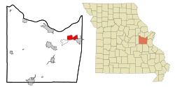 Location of Gray Summit, Missouri | |
| Coordinates: 38°29′42″N 90°48′55″W / 38.49500°N 90.81528°W / 38.49500; -90.81528Coordinates: 38°29′42″N 90°48′55″W / 38.49500°N 90.81528°W / 38.49500; -90.81528 | |
| Country | United States |
| State | Missouri |
| County | Franklin |
| Area | |
| • Total | 7.27 sq mi (18.83 km2) |
| • Land | 7.25 sq mi (18.78 km2) |
| • Water | 0.02 sq mi (0.05 km2) |
| Elevation | 666 ft (203 m) |
| Population (2010) | |
| • Total | 2,701 |
| • Density | 372/sq mi (143.8/km2) |
| Time zone | UTC-6 (Central (CST)) |
| • Summer (DST) | UTC-5 (CDT) |
| ZIP code | 63039 |
| Area code(s) | 636 |
| FIPS code | 29-28918[1] |
GNIS feature ID | 0731576[2] |
Gray Summit is an unincorporated community and census-designated place (CDP) in Franklin County, Missouri, United States. The population was 2,701 at the 2010 census.[3] Also called "Gray's Summit", it was founded by Daniel Gray of New York, who built a hotel here in 1845. This community was the highest point on the Missouri Pacific Railroad between St. Louis and Jefferson City, Missouri;[4] a railroad tunnel runs underneath the community. It is located on Interstate 44 and is home to Purina Farms, the Shaw Nature Reserve and Point Labaddie Brewery.
Geography
Gray Summit is located in northeastern Franklin County at 38°29′42″N 90°48′55″W / 38.49500°N 90.81528°W / 38.49500; -90.81528 (38.494902, -90.815314).[5] Via Interstate 44 it is 38 miles (61 km) southwest of St. Louis and 30 miles (48 km) northeast of Sullivan. Missouri Route 100 leads northwest 11 miles (18 km) to Washington from the west end of Gray Summit.
According to the United States Census Bureau, the CDP has a total area of 7.27 square miles (18.83 km2), of which 7.25 square miles (18.78 km2) is land and 0.02 square miles (0.05 km2), or 0.28%, is water.[3]
Demographics
| Historical population | |||
|---|---|---|---|
| Census | Pop. | %± | |
| 1990 | 2,505 | — | |
| 2000 | 2,640 | 5.4% | |
| 2010 | 2,701 | 2.3% | |
| U.S. Decennial Census | |||
As of the census[1] of 2000, there were 2,640 people, 953 households, and 739 families residing in the CDP. The population density was 355.1 people per square mile (137.2/km²). There were 1,032 housing units at an average density of 138.8/sq mi (53.6/km²). The racial makeup of the CDP was 97.80% White, 0.38% African American, 0.23% Native American, 0.15% Asian, 0.08% Pacific Islander, 0.38% from other races, and 0.98% from two or more races. Hispanic or Latino people of any race were 0.34% of the population.
There were 953 households out of which 37.5% had children under the age of 18 living with them, 64.3% were married couples living together, 8.4% had a female householder with no husband present, and 22.4% were non-families. 17.3% of all households were made up of individuals and 5.9% had someone living alone who was 65 years of age or older. The average household size was 2.77 and the average family size was 3.12.
In the CDP, the population was spread out with 27.8% under the age of 18, 8.1% from 18 to 24, 34.0% from 25 to 44, 21.2% from 45 to 64, and 9.0% who were 65 years of age or older. The median age was 35 years. For every 100 females, there were 98.5 males. For every 100 females age 18 and over, there were 97.0 males.
The median income for a household in the CDP was $46,648, and the median income for a family was $53,875. Males had a median income of $38,810 versus $21,723 for females. The per capita income for the CDP was $17,503. About 4.8% of families and 5.1% of the population were below the poverty line, including 5.2% of those under age 18 and 15.5% of those age 65 or over.
References
^ ab "American FactFinder". United States Census Bureau. Archived from the original on 2013-09-11. Retrieved 2008-01-31..mw-parser-output cite.citation{font-style:inherit}.mw-parser-output .citation q{quotes:"""""""'""'"}.mw-parser-output .citation .cs1-lock-free a{background:url("//upload.wikimedia.org/wikipedia/commons/thumb/6/65/Lock-green.svg/9px-Lock-green.svg.png")no-repeat;background-position:right .1em center}.mw-parser-output .citation .cs1-lock-limited a,.mw-parser-output .citation .cs1-lock-registration a{background:url("//upload.wikimedia.org/wikipedia/commons/thumb/d/d6/Lock-gray-alt-2.svg/9px-Lock-gray-alt-2.svg.png")no-repeat;background-position:right .1em center}.mw-parser-output .citation .cs1-lock-subscription a{background:url("//upload.wikimedia.org/wikipedia/commons/thumb/a/aa/Lock-red-alt-2.svg/9px-Lock-red-alt-2.svg.png")no-repeat;background-position:right .1em center}.mw-parser-output .cs1-subscription,.mw-parser-output .cs1-registration{color:#555}.mw-parser-output .cs1-subscription span,.mw-parser-output .cs1-registration span{border-bottom:1px dotted;cursor:help}.mw-parser-output .cs1-ws-icon a{background:url("//upload.wikimedia.org/wikipedia/commons/thumb/4/4c/Wikisource-logo.svg/12px-Wikisource-logo.svg.png")no-repeat;background-position:right .1em center}.mw-parser-output code.cs1-code{color:inherit;background:inherit;border:inherit;padding:inherit}.mw-parser-output .cs1-hidden-error{display:none;font-size:100%}.mw-parser-output .cs1-visible-error{font-size:100%}.mw-parser-output .cs1-maint{display:none;color:#33aa33;margin-left:0.3em}.mw-parser-output .cs1-subscription,.mw-parser-output .cs1-registration,.mw-parser-output .cs1-format{font-size:95%}.mw-parser-output .cs1-kern-left,.mw-parser-output .cs1-kern-wl-left{padding-left:0.2em}.mw-parser-output .cs1-kern-right,.mw-parser-output .cs1-kern-wl-right{padding-right:0.2em}
^ "US Board on Geographic Names". United States Geological Survey. 2007-10-25. Retrieved 2008-01-31.
^ ab "Geographic Identifiers: 2010 Census Summary File 1 (G001), Gray Summit CDP, Missouri". American FactFinder. U.S. Census Bureau. Retrieved June 5, 2016.
^ U.S. Geological Survey topographic maps
^ "US Gazetteer files: 2010, 2000, and 1990". United States Census Bureau. 2011-02-12. Retrieved 2011-04-23.
Municipalities and communities of Franklin County, Missouri, United States | ||
|---|---|---|
County seat: Union | ||
| Cities |
|  |
| Villages |
| |
| Townships |
| |
| CDPs |
| |
| Other unincorporated communities |
| |
| Ghost towns |
| |
| Footnotes | ‡This populated place also has portions in an adjacent county or counties | |


Comments
Post a Comment