 Mixing
Kohistan District, Pakistan
Kohistan | |
|---|---|
District | |
| Kohistan District | |
 Kohistan is noted for its dramatic mountain scenery | |
| Coordinates: 35°15′N 73°30′E / 35.250°N 73.500°E / 35.250; 73.500Coordinates: 35°15′N 73°30′E / 35.250°N 73.500°E / 35.250; 73.500 | |
| Country | Pakistan |
| Province | Khyber Pakhtunkhwa |
| Established | 1 October 1976-2014 |
| Headquarters | Dasu |
| Government | |
| • Deputy Commissioner | Mushtaq Ahmad[1] |
| • Zila Naib Nazim | Local election is awaited |
| Area | |
| • Total | 7,492 km2 (2,893 sq mi) |
| Population (2017)[2] | |
| • Total | 784,711 |
| • Density | 100/km2 (270/sq mi) |
| Time zone | UTC+5 (PST) |
| Languages | Kohistani, Shina, Urdu, Pashto |
| Ethnicity | Dardic Kohistanis, Pashtuns |
Kohistan (Urdu: کوہستان, Pashto: اباسين کوهستان; "Land of Mountains"), also called Abasin Kohistan or Indus Kohistan, was an administrative district within Khyber Pakhtunkhwa Province in Pakistan, covering an area of 7,492 square kilometres (2,893 sq mi); it had a population of 472,570 at the 1998 Census. Geographically, Kohistan stretches from the border with Kashmir and Gilgit-Baltistan in the east and north to Swat and Shangla in the west, and Mansehra and Battagram District in the south.
In 2014, the government bifurcated Kohistan District into Upper Kohistan and Lower Kohistan, carving out one more administrative unit.
Contents
1 Administrative divisions
2 Geography
3 Education
4 See also
5 References
Administrative divisions
The District is represented in the National Assembly of Pakistan & provincial assembly by three elected MNA & MPAs who represent the following constituencies:[3]
- NA-11 (Kohistan)
- PK-25 (Kohistan-1)
- PK-26 (Kohistan-2)
- PK-27 (Kohistan-3)
Since the 2014 Kohistan District split, each of the new districts are subdivided into two tehsils (subdivisions):
Upper Kohistan
Dasu (district capital)- Kandia
Lower Kohistan
- Palas
Pattan (district capital)
Geography

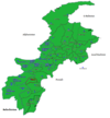
Map of Kohistan district
The District lies between 34° 54′ and 35° 52′ north latitudes and 72° 43′ and 73° 57′ east longitudes. It is bounded on the north and northeast by Ghizer and Diamer Districts of northern areas, on the southeast by Manshera District on the south by Battragram District and on the west by shangla and Swat Districts
Kohistan is where the Hindukush, Karakuram and Himalayan mountain systems meet and serve as a natural boundary for environmental regions in the chains of the Himalayas, Karakoram and Hindu Kush mountains. This uniqueness of the mountains system also results in rich flora and fauna and therefore gives home to unique species such as the western tragopan pheasant and the snow leopard.[4]
Education
The literacy rate of the District among the population aged 10 years and above is 11.1%: male 17.23% and female 2.95%. The proportion of working or employed population to population aged 10 years and above is 26.47% which is 70.53% of the total labor force. Out of the total employed population, 71.60% are self-employed, 10.68% work as employees, and 17.32% are unpaid family helper.
Kohistan's literacy rate is amongst the lowest in Pakistan and hovers around 20%.[5] It has the lowest Human Development Index of all districts in the Khyber Pakhtunkhwa.
See also
- Khyber Pakhtunkhwa
- February 2012 Kohistan Killings
References
^ {http://www.khyberpakhtunkhwa.gov.pk/GoServices/NewsDetails.php?NewsId=2302}
^ "DISTRICT WISE CENSUS RESULTS CENSUS 2017" (PDF). www.pbscensus.gov.pk. Archived from the original (PDF) on 29 August 2017..mw-parser-output cite.citation{font-style:inherit}.mw-parser-output .citation q{quotes:"""""""'""'"}.mw-parser-output .citation .cs1-lock-free a{background:url("//upload.wikimedia.org/wikipedia/commons/thumb/6/65/Lock-green.svg/9px-Lock-green.svg.png")no-repeat;background-position:right .1em center}.mw-parser-output .citation .cs1-lock-limited a,.mw-parser-output .citation .cs1-lock-registration a{background:url("//upload.wikimedia.org/wikipedia/commons/thumb/d/d6/Lock-gray-alt-2.svg/9px-Lock-gray-alt-2.svg.png")no-repeat;background-position:right .1em center}.mw-parser-output .citation .cs1-lock-subscription a{background:url("//upload.wikimedia.org/wikipedia/commons/thumb/a/aa/Lock-red-alt-2.svg/9px-Lock-red-alt-2.svg.png")no-repeat;background-position:right .1em center}.mw-parser-output .cs1-subscription,.mw-parser-output .cs1-registration{color:#555}.mw-parser-output .cs1-subscription span,.mw-parser-output .cs1-registration span{border-bottom:1px dotted;cursor:help}.mw-parser-output .cs1-ws-icon a{background:url("//upload.wikimedia.org/wikipedia/commons/thumb/4/4c/Wikisource-logo.svg/12px-Wikisource-logo.svg.png")no-repeat;background-position:right .1em center}.mw-parser-output code.cs1-code{color:inherit;background:inherit;border:inherit;padding:inherit}.mw-parser-output .cs1-hidden-error{display:none;font-size:100%}.mw-parser-output .cs1-visible-error{font-size:100%}.mw-parser-output .cs1-maint{display:none;color:#33aa33;margin-left:0.3em}.mw-parser-output .cs1-subscription,.mw-parser-output .cs1-registration,.mw-parser-output .cs1-format{font-size:95%}.mw-parser-output .cs1-kern-left,.mw-parser-output .cs1-kern-wl-left{padding-left:0.2em}.mw-parser-output .cs1-kern-right,.mw-parser-output .cs1-kern-wl-right{padding-right:0.2em}
^ Constituencies and MPAs - Website of the Provincial Assembly of the NWFP[permanent dead link]
^ District Profile ERRA
^ "Archived copy" (PDF). Archived from the original (PDF) on 2010-11-13. Retrieved 2010-09-28.CS1 maint: Archived copy as title (link)
Districts of Khyber Pakhtunkhwa | ||
|---|---|---|
Provincial capital: Peshawar | ||
| Divisions | Districts |
 |
| Bannu |
|
|
| Dera Ismail Khan |
|
|
| Hazara |
|
|
| Kohat |
|
|
| Malakand |
|
|
| Mardan |
|
|
| Peshawar |
|
|
Administrative divisions of Kohistan District | ||
|---|---|---|
| Capital |
|
|
| Tehsils |
|
|
| Union councils |
|
|


Comments
Post a Comment