 Mixing
Electoral district of Sydenham
Sydenham Victoria—Legislative Assembly | |
|---|---|
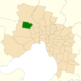 Location of Sydenham (dark green) in Greater Melbourne | |
| State | Victoria |
| Created | 2014 |
| MP | Natalie Hutchins |
| Party | Labor |
| Electors | 50,841 (2018) |
| Area | 60 km2 (23.2 sq mi) |
| Demographic | Metropolitan |
The electoral district of Sydenham is an electoral district of the Victorian Legislative Assembly in Australia. It was created in the redistribution of electoral boundaries in 2013, and came into effect at the 2014 state election.[1]
It largely covers the area of the abolished district of Keilor, covering outer northwestern suburbs of Melbourne. It includes the suburbs of Sydenham, Taylors Hill, Delahey, Taylors Lakes and Hillside.[2]
The abolished district of Keilor was held by Labor MP Natalie Hutchins, who retained the new seat at the 2014 election.
Contents
1 Members
2 Election results
3 References
4 External links
Members
| Member | Party | Term |
|
|---|---|---|---|
| |
Natalie Hutchins |
Labor |
2014–present |
Election results
| Party |
Candidate |
Votes |
% |
± |
|
|---|---|---|---|---|---|
Labor |
Natalie Hutchins |
26,264 |
60.94 |
+3.57 |
|
Liberal |
Maria Kerr |
12,303 |
28.54 |
+0.53 |
|
Greens |
Clinton Hare |
2,754 |
6.39 |
−0.71 |
|
Independent |
Ramanjit Singh |
1,780 |
4.13 |
+4.13 |
|
| Total formal votes |
43,101 |
92.83 |
−0.55 |
||
| Informal votes |
3,329 |
7.17 |
+0.55 |
||
Turnout |
46,430 |
91.32 |
−2.42 |
||
Two-party-preferred result | |||||
Labor |
Natalie Hutchins |
29,018 |
67.86 |
+1.60 |
|
Liberal |
Maria Kerr |
13,743 |
32.14 |
−1.60 |
|
Labor hold |
Swing |
+1.60 |
|||
References
^ "Summary of Changes". Victorian Electoral Boundary Commission. Retrieved 17 October 2013..mw-parser-output cite.citation{font-style:inherit}.mw-parser-output .citation q{quotes:"""""""'""'"}.mw-parser-output .citation .cs1-lock-free a{background:url("//upload.wikimedia.org/wikipedia/commons/thumb/6/65/Lock-green.svg/9px-Lock-green.svg.png")no-repeat;background-position:right .1em center}.mw-parser-output .citation .cs1-lock-limited a,.mw-parser-output .citation .cs1-lock-registration a{background:url("//upload.wikimedia.org/wikipedia/commons/thumb/d/d6/Lock-gray-alt-2.svg/9px-Lock-gray-alt-2.svg.png")no-repeat;background-position:right .1em center}.mw-parser-output .citation .cs1-lock-subscription a{background:url("//upload.wikimedia.org/wikipedia/commons/thumb/a/aa/Lock-red-alt-2.svg/9px-Lock-red-alt-2.svg.png")no-repeat;background-position:right .1em center}.mw-parser-output .cs1-subscription,.mw-parser-output .cs1-registration{color:#555}.mw-parser-output .cs1-subscription span,.mw-parser-output .cs1-registration span{border-bottom:1px dotted;cursor:help}.mw-parser-output .cs1-ws-icon a{background:url("//upload.wikimedia.org/wikipedia/commons/thumb/4/4c/Wikisource-logo.svg/12px-Wikisource-logo.svg.png")no-repeat;background-position:right .1em center}.mw-parser-output code.cs1-code{color:inherit;background:inherit;border:inherit;padding:inherit}.mw-parser-output .cs1-hidden-error{display:none;font-size:100%}.mw-parser-output .cs1-visible-error{font-size:100%}.mw-parser-output .cs1-maint{display:none;color:#33aa33;margin-left:0.3em}.mw-parser-output .cs1-subscription,.mw-parser-output .cs1-registration,.mw-parser-output .cs1-format{font-size:95%}.mw-parser-output .cs1-kern-left,.mw-parser-output .cs1-kern-wl-left{padding-left:0.2em}.mw-parser-output .cs1-kern-right,.mw-parser-output .cs1-kern-wl-right{padding-right:0.2em}
[permanent dead link]
^ "Map of Sydenham District". Victorian Electoral Boundaries Commission.
^ State Election 2018: Sydenham District, VEC.
External links
- District profile from the Victorian Electoral Commission


Comments
Post a Comment